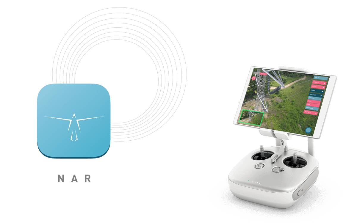
NAR
NAR is a tablet-based app that automates drone data management at a fraction of the time and cost. NAR is the first application that enables image labelling, organization, packaging, and sharing on the fly and in offline mode.

Complete more inspections
by optimizing budget and time

Enable greater engineer focus
on asset analysis and assessment

Improve customer satisfaction
with timely report deliveries
WORKFLOW
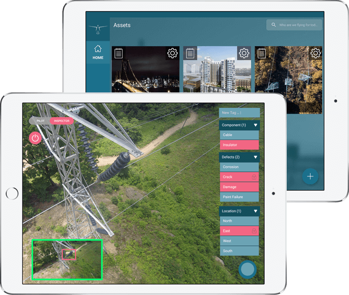
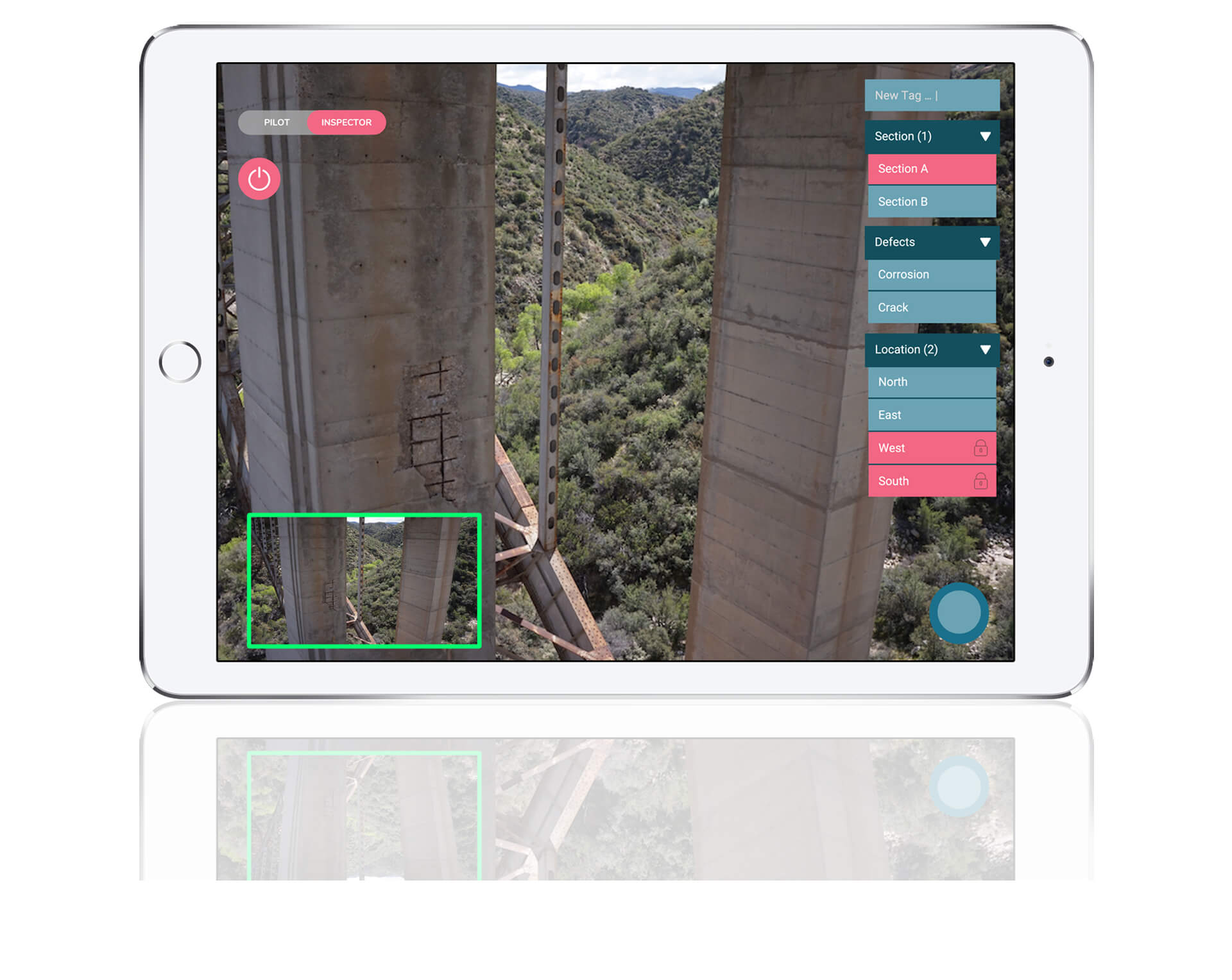
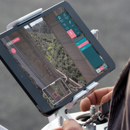
Label images on the fly
Why simply capture images during inspections? NAR enables users to capture and instantly label images on the fly by tapping on their tablet screen, saving processing time at the office. Whether it’s a defect, location, component, or other point of interest, NAR users are now capable of logging and cataloging them in real time.
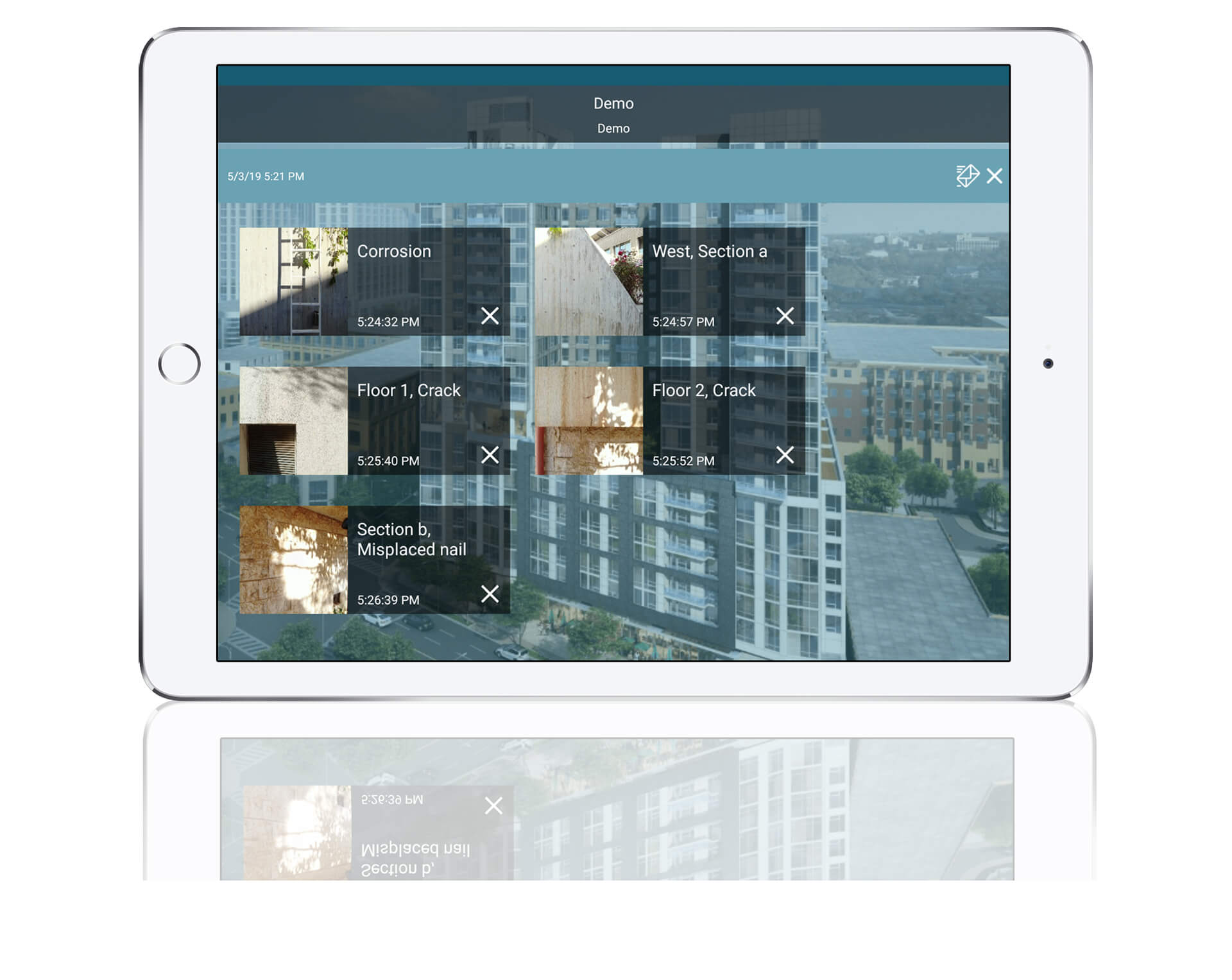
Review images offline as soon as you land or online
Why wait hours for pictures to be uploaded online before reviewing and editing them? NAR users can now review and edit their inspection images in offline mode as soon as an inspection drone lands. The labelled images can also be uploaded through the NAR app for review in an office setting on a bigger screen, enabling a more thorough analysis.
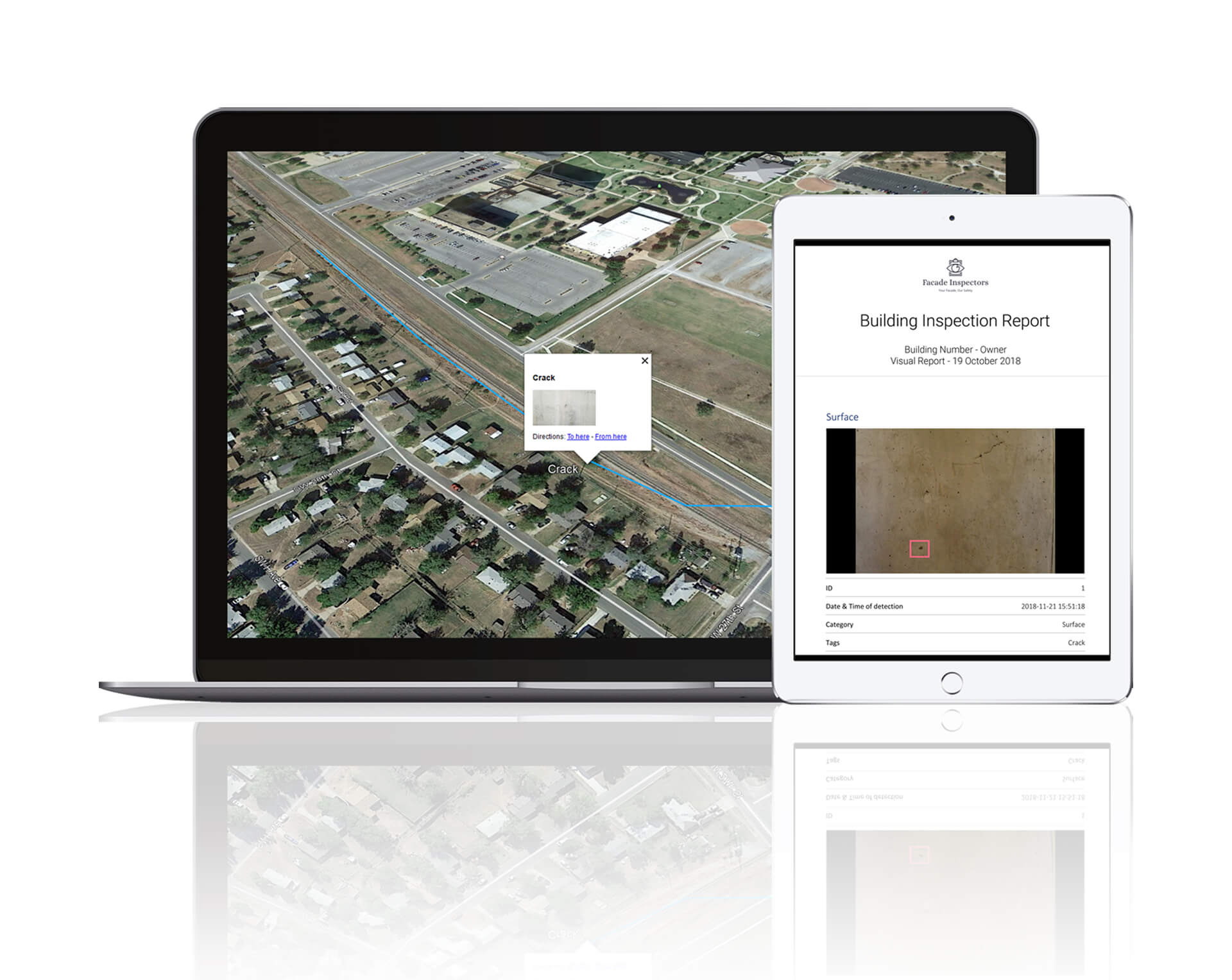
Create inspection reports in PDF, CSV, KML formats
Instantly package labeled images upon landing or after thorough revision at the office in various formats such as PDF, CSV, KML or simply decide to share them online. Exported data contains the image and its corresponding label, GPS coordintates, timestamp and any additional information logged.
WORKFLOW
Label images on the fly
Why simply capture images during inspections? NAR enables users to capture and instantly label images on the fly by tapping on their tablet screen, saving processing time at the office. Whether it’s a defect, location, component, or other point of interest, NAR users are now capable of logging and cataloging them in real time.
Review images offline as soon as you land or online
Why wait hours for pictures to be uploaded online before reviewing and editing them? NAR users can now review and edit their inspection images in offline mode as soon as an inspection drone lands. The labelled images can also be uploaded through the NAR app for review in an office setting on a bigger screen, enabling a more thorough analysis.
Create inspection reports in PDF, CSV, KML formats
Instantly package labeled images upon landing or after thorough revision at the office in various formats such as PDF, CSV, KML or simply decide to share them online. Exported data contains the image and its corresponding label, GPS coordintates, timestamp and any additional information logged.
Start automating your data management today!
RESOURCES
-
VOLT Inspections reduced their drone data management time from 36 hours to 4 minutes using the NAR app!
in Use CasesIn the post below our client Dusty Birge CEO of UAV Recon describes how NAR | the Live Dat...
-
NAR Software To Save Weeks of Data Analysis During Delaware Memorial Bridge Inspection
in Use CasesThis post describes a use case of NAR software during an inspection of the Delaware Memori...
IN ACTION
5,000+
HOURS OF
INSPECTIONS
COMPLETED
1,000+
REAL-TIME
REPORTS
GENERATED
6
ASSET TYPES
INSPECTED
REDUCED TIME
SPENT ON
REPORTS BY
85%
10,000+
DEFECTS LOGGED